Drones for environmental monitoring in remote areas
Advertisements
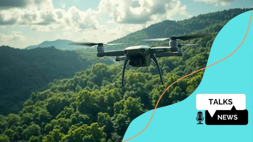
Drones for environmental monitoring in remote areas enhance data collection, improve wildlife tracking, and help conservationists monitor ecosystems efficiently, utilizing advanced technologies like AI and high-resolution sensors.
Drones for environmental monitoring in remote areas are becoming essential tools for researchers and conservationists. Have you ever wondered how technology can help protect our planet in hard-to-reach places? Let’s dive into this fascinating topic.
Benefits of using drones for monitoring
Using drones for monitoring offers many advantages that enhance data collection and environmental assessment. These devices are versatile, capable of reaching areas that are often inaccessible for traditional monitoring.
Increased efficiency and coverage
Drones can cover large areas in a short time. This efficiency is crucial when monitoring vast landscapes or sensitive ecosystems. With aerial views, researchers can quickly identify changes in vegetation, water bodies, and wildlife.
Cost-effectiveness
Utilizing drones reduces the need for expensive equipment and labor. Drones can gather extensive data without the high costs typically associated with manned aircraft or ground surveys. Additionally, they fit into budget-friendly strategies for conservation projects.
- Lower operational costs
- Reduced manpower requirements
- Minimized environmental impact
Moreover, drones can provide high-resolution imagery and data analytics, which are vital for precise monitoring. This level of detail helps scientists make better-informed decisions. By providing real-time monitoring, drones empower researchers to act swiftly when challenges arise.
Enhanced safety
Safety is another crucial benefit. Drones can access hazardous areas without putting human operators at risk. This is particularly important in remote locations where conditions can be unpredictable.
As technology continues to evolve, the capabilities of drones will likely expand, offering even more innovative ways to monitor the environment.
How drones improve data accuracy
Drones play a vital role in enhancing data accuracy for environmental monitoring. By utilizing advanced technology, they collect precise information that contributes significantly to research and conservation efforts.
High-resolution imagery
The use of drones allows scientists to obtain high-resolution images of landscapes. This detailed imagery helps in identifying specific plant species, tracking wildlife movements, and spotting changes in ecosystem health.
Real-time data collection
Another advantage of using drones is the ability to gather real-time data. This immediate information is crucial when monitoring environmental changes, such as flooding or forest fires. By responding quickly to these events, researchers can tackle problems before they escalate.
- Consistent data collection over time
- Ability to adjust monitoring based on findings
- Integration with other data sources
Furthermore, the accuracy of drones is enhanced by the use of GPS and sensor technologies. These tools help pinpoint locations and provide additional context, making the collected data even more reliable. The combination of aerial views and precise measurements transforms how scientists approach their studies.
In many cases, drones can collect data in difficult-to-reach locations, allowing for a comprehensive view of ecosystems that might be challenging to assess on foot. This not only broadens the scope of research but also increases overall data accuracy.
Challenges in remote drone operations

Operating drones in remote areas presents unique challenges that can hinder efficient environmental monitoring. These difficulties arise from both environmental factors and technical limitations.
Environmental obstacles
One major challenge is the unpredictable nature of weather conditions. High winds, rain, and snow can limit the effectiveness of drones, making it difficult to collect data consistently. These elements not only affect flight stability but can also damage equipment.
Technical issues
Another significant hurdle involves technical reliability. In remote locations, maintaining a continuous signal can be problematic. Lost connections between the drone and the operator can lead to loss of data or even the drone itself.
- Interference from natural features, such as mountains and forests
- Battery life limitations during long missions
- Difficulty in transporting equipment to remote sites
The terrain also poses challenges for drones. Uneven or rugged landscapes can make it hard to launch and recover flying devices. Additionally, navigating these areas requires careful planning to avoid obstacles and ensure successful operation.
Despite these challenges, many researchers and conservationists find innovative solutions to overcome them. For instance, utilizing advanced navigation systems can help mitigate the effects of uneven terrain and unreliable signals. Thus, while the obstacles are significant, they are not insurmountable.
Case studies of drone use in conservation
Many successful case studies demonstrate how drones are revolutionizing conservation efforts. These examples highlight the practical benefits and innovative applications of drone technology in protecting ecosystems and wildlife.
Monitoring wildlife populations
One prominent case study involved monitoring the population of endangered species in a national park. Researchers used drones to conduct aerial surveys, allowing them to count animals without disturbing their natural habitats. This method proved more effective than traditional ground surveys, which often missed animals hidden in dense vegetation.
Habitat mapping and assessment
Another example focused on mapping habitats in remote locations. Drones equipped with advanced sensors captured high-resolution images, enabling scientists to identify significant changes in land use and vegetation health over time. This information is crucial for effective management and restoration efforts.
- Identified critical habitats for restoration
- Monitored the effects of climate change
- Assisted in planning conservation areas
Additionally, drones have been utilized for anti-poaching efforts. In regions where poaching threatens wildlife, drones provide real-time surveillance over large areas. This timely monitoring helps conservationists detect poachers before they can harm endangered animals.
These case studies illustrate the undeniable impact of drones on conservation practices. By improving data collection and enhancing surveillance, drones contribute significantly to the preservation of biodiversity and habitat integrity.
Future trends in drone technology and ecology
The future of drones in technology and ecology looks promising, as advancements continue to shape how we understand and interact with our environment. Emerging trends suggest that drone technology will play a vital role in both ecological research and conservation efforts.
Integration with artificial intelligence
One exciting trend is the integration of artificial intelligence (AI) with drone technology. This combination enables drones to analyze data on the fly and make decisions based on real-time information. For instance, AI can help identify specific species in images captured by drones, which enhances wildlife monitoring.
Advanced sensors and data collection
Another trend involves the development of advanced sensors that can gather more detailed data than ever before. Multispectral sensors can now detect changes in plant health, while thermal sensors help track animal movements at night. These innovations are crucial for understanding complex ecosystems.
- Real-time data processing
- Improved monitoring of climate change effects
- Enhanced mapping and modeling capabilities
Additionally, as drone technology becomes more affordable, more researchers and conservationists can utilize these tools. This increase in accessibility will likely lead to broader applications in environmental monitoring. Drones are expected to become standard in conservation efforts, aiding in everything from habitat restoration to tracking endangered species.
As regulations around drone use evolve, we can expect more widespread acceptance of these technologies. This will encourage innovation and lead to even more effective solutions for ecological challenges. The future is bright for drones and their role in advancing our understanding of the environment.
FAQ – Frequently Asked Questions about Drones in Environmental Monitoring
How do drones improve wildlife monitoring?
Drones provide detailed aerial data, allowing researchers to track animal populations and behaviors without disturbing their natural habitats.
What are the main challenges of using drones in remote areas?
Challenges include unpredictable weather, signal interference, and difficult terrain that can hinder drone operations.
What role does AI play in drone technology?
AI enhances drones by enabling real-time data analysis, which improves accuracy in monitoring and data collection.
How are drones impacting conservation efforts?
Drones help in precise data collection, monitoring ecosystems, and preventing poaching, making them essential tools for conservation.


